Projects

Brownfields in North Carolina website
I created this website for a cartography class. This site demonstrates my ability to produce maps for the web.
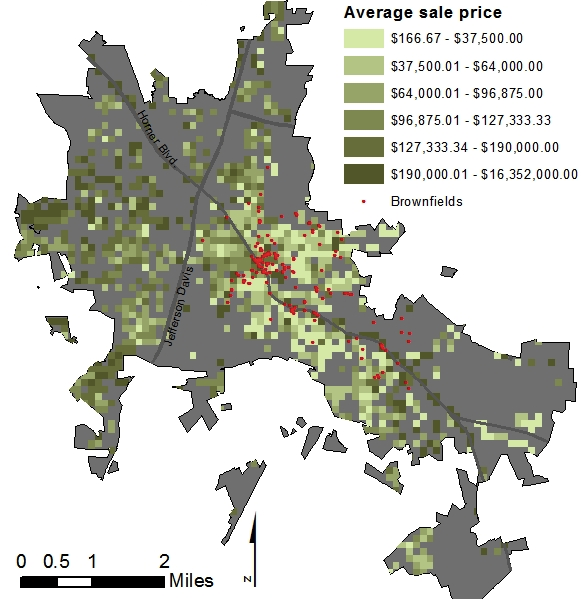
Brownfields and Real Estate
This poster, created in ArcMap, addresses the relationship between brownfield sites and real estate sales in Sanford, NC.
Checking up on Reality Check
I participated in a Land Use Planning Workshop at the UNC Department of City and Regional Planning that culminated in the creation of a report comparing different growth scenarios for the Research Triangle, NC region. This workshop was a follow-up to the 2009 Reality Check exercise held by the Urban Land Institute and Triangle Tomorrow, in which stakeholders from the 15-county region were invited to create scenarios distributing the region's projected population and employment for the year 2030. The workshop then compared the costs and benefits of the compact, transit-oriented scenarios proposed by participants in the Reality Check exercise to the region's current low-density, auto-oriented development patterns.
I wrote this excerpt of the report, which compares impervious surface under each scenario. The analysis was done with ArcGIS using data from the U.S. Geological Survey. The full report can be found here.
Writing Sample
This writing sample is an excerpt from an issue paper analyzing the problem of brownfields and vacant property in Greensboro, N.C. The sample was written for a class on Development and Environmental Management.